Our Forgotten Places: Coliban Falls
Waterfalls have long been a source of fascination for travellers and tourists. Aside from its picturesque quality, water cascading from a height provides a special visceral thrill to which few are immune. Dramatic disjunctions in river and creek levels created during ancient cataclysmic events can be found throughout Victoria, and Central Victoria is no exception. Those waterfalls that fall within public land remain accessible but many of those bounded by private land have been locked away, in many cases forgotten by all but locals and the landowners themselves.
The Coliban Falls situated within the Coliban Falls Geological Reserve, but otherwise isolated and surrounded by farmland, is a case in point. Once it was a popular tourist spot, known far and wide, not least because of its association with Major Mitchell's expedition of 1836. The painting above is based on Mitchell's own drawing of the Falls (then known as The Falls of Cobaw) and shows that among Mitchell's many talents he was an observant and skilled artist.
Before we walk together to the Falls along the only path still available to us, let's look at some stories associated with this magical location. I'm unable to relate those of the Dja Dja Wurring, the indigenous people who once inhabited the area, in fact I'm unsure if those stories have ever been recorded. I can only pick up the story with Mitchell's 1836 expedition. Here is what he has to say about his discovery of the Falls ('Continue Our Homeward Journey, Three Expeditions into the Interior of Eastern Australia', Thomas Mitchell):
'Oct 3: A clear morning: I buried another letter for Mr. Stapylton, informing him how he might best avoid the mud; and then we proceeded along the highest points of the ground, thus keeping clear of that which was boggy, and we found the surface to improve much in this respect as we receded from the base of the higher range... The various rivulets we crossed fell southwards into one we had seen in a valley on our right which continued from the base of the mountain, and this rivulet at length entered a still deeper valley in which there was very little wood, the hills on the opposite side being uncommonly level at the top. In this valley a fine stream ran northward, being undoubtedly the Barnard, or first river crossed by us on our way to Mount Macedon. We succeeded in finding a ford, but although it was deep a greater difficulty to be overcome was the descent of our carts to it, so abrupt and steep-sided was the ravine in which the Barnard flowed'.
This passage describes the countryside Mitchell travels through as he heads homewards, east from his camp south of Mount Alexander. The rivulet he follows to reach the Barnard (Coliban) River may well have been Granite Creek which flows southeast to join the Coliban a little to the north of the Coliban Falls. The hills along the Coliban River near here are indeed 'uncommonly level at the top'.
'When we had effected at length a descent and a passage across, having also established our camp beyond this stream, I rode up the bank towards a noise of falling water, and thus came to a very fine cascade of upwards of sixty feet. The river indeed fell more than double that height, but in the lower part the water escaped unseen, flowing amongst large blocks of granite. I had visited several waterfalls in Scotland, but this was certainly the most picturesque I had witnessed; although the effect was not so much in the body of water falling, or the loud noise, as in the bold character of the rocks over and amongst which it fell. Their colour and shape were harmonized into a more complete scene than nature usually presents, resembling the finished subject of an artist, foreground and all. The prevailing hues were light red and purple-grey, the rocks being finely interlaced with a small-leaved creeper of the brightest green. A dark-coloured moss, which presents a warm green in the sun, covered the lower masses and relieved and supported the brighter hues, while a brilliant iris shone steadily in the spray, and blended into perfect harmony the lighter hues of the higher rocks and the whiteness of the torrent rushing over them. The banks of this stream were of so bold a character that in all probability other picturesque scenery, perhaps finer than this, may yet be found upon it'.
As I was writing this article I chanced upon the following passage in George Steiner's 'Language and Silence' p 43, Pelican, 1967. He is writing about aesthetics and how we respond to abstract art: '(an) assertion of immediate sensuous energy provokes in the viewer a kinetic response. There are shapes by Brancusi and Arp that draw us after them into a counterpart of their own motion'. Did Edith, upon looking up from reading her book and becoming momentarily disorientated, find herself being drawn into the pool below the waterfall through just such a kinetic response? One thing we can assuredly assert, once saturated, the long heavy dresses worn by women in the early 20th century would have made it very difficult for a non swimmer to attain the river bank.
A little to the south of the Granite Creek bridge there is a flat area by the road. It might be a bit sticky after heavy rain. I suggest inspecting it carefully before parking here.
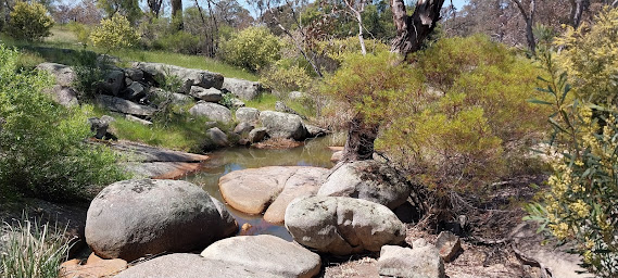
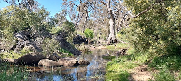
One option is to walk part of the way to the Falls along the southern bank of Granite Creek (red hatched line) and return via the northern bank (yellow hatched line). Those who simply wish for the easiest path will stick to the northern side of the creek where there is a generously proportioned creek reserve. The creek here is very attractive with granite rocks and limpid pools.
Whether walking the southern or the northern bank keep an eye out for snakes, the grass being high enough to give them excellent cover.
In about 1.5 km an attractive gorge is reached. I've found that the western side of the creek gives the best view.
If heading out along the south side of the creek, be sure to turn the corner after this gorge and head northeast. In about 700 m it's time to cross the creek as it's a dead end ahead. If you pass this giant red gum you've gone too far.
I doubt if the landscape has changed much since Mitchell's expedition wound its way among these hills almost 200 years ago.
About 1.8 km after turning the corner you will encounter a waterfall on Granite Creek. It must be a spectacular sight after heavy rain. It's quite difficult to photograph from the northern bank. I suspect the metal cable marks out a property boundary unless it's something to hold onto while crossing the creek!
This waterfall is a little tricky to pass, as the creek reserve is not only narrow at this point, it slopes away quite steeply towards the falls. Keep as close to the fence as possible (shown here on the left). But not so close as to be zapped by the electric wire! You'll need to climb over an old (unelectrified) fence a little further down the slope.
Did you manage to get past this section? It was fun wasn't it? It's mostly plain sailing after this. Down at the very bottom, the next step is to cross Granite Creek. There is an old stone fence over to your right here.
But there's still one challenge before you reach the Falls. Head up through the gorse and follow a sandy patch as far as you can and then it's a matter of rock hopping up the valley. One misstep and a broken ankle awaits.
There may be an easier path on the eastern side of the river but I've yet to find it. The next time I go there I'll investigate more thoroughly because hopping from rock to rock certainly becomes tiresome and tiring! Nevertheless a fine sight awaits you, especially if a good volume of water is coming down the river.
And now there's the walk back to your car to look forward to. I hope you've enjoyed your trip to Coliban Falls and have gained a renewed respect for the 19th century Victorians who flocked to these falls for a picnic. They were certainly a hardy breed!


Comments
Post a Comment