
Swing (or Suspension) Bridge, Tipperary Springs, Daylesford ca. 1916, photographer unknown, State Library.
Like quite a number of budding ramblers I enjoyed ticking off the walks described in Tyrone Thomas's popular bushwalking books published last century, in particular, '
60 Walks in Central Victoria's Gold Fields and Spa Country' (Second edition, 1994), a book which inspired me to discover the charms of this previously unexplored region. One of the first walks I did, about 25 years ago, was Walk 13, page 75, 'The Taradale-Metcalfe Forest'. A short time later I moved up into the area and I've now done the walk a number of times, only these days I'm more attentive to the rich history of the region, and in particular, the interesting story behind Swing Bridge Road, Taradale.
Here is a map of the wider area. It's an amalgam of a contemporary Google Earth view overlaid on an 1861 map ('Goldfields Map: Showing the position of the gold workings being carried out in the vicinity of the townships of Taradale and Malmsbury in the Taradale Division of the Castlemaine District. May 2nd 1861', State Library). The latter map is beautifully detailed and contains a wealth of information about old mines and mining infrastructure, mostly long forgotten. The numbers represent items of particular historical interest.

The red hatched line represents the alignment of the present day Swing Bridge Road, Taradale. But before we stroll along it, let's look at some nearby features. We'll be walking the road from west to east. (A good place to park is at the old Taradale Train Station at the end of Station Street off Potts Road, or alternatively, there's space for a couple of cars down Swing Bridge Road just before Kirks Ford). So, on the far top left of the map we can see that a major route to Kyneton and the Barfold Diggings (7), the black line, coincided with what is now Swifts Lane (1), Taradale. This track crossed Potts Road (following what is now the private driveway of a farm), ran down to the river, crossed at an early ford (3a), before following an unnamed tributary of the Coliban river eastwards.
Apparently, even as late as 1917, this northern track was still navigable, according to this Tourist map of the district, although not perhaps for motor vehicles.
Further south, another branch of the track began near the Taradale Railway Station and left Potts Road a little north of the present day Swing Bridge Road. It seems that it forded the Coliban River (3b) a little further north than Swing Bridge Road does now. After the river was crossed, the track skirted a hill, joined the northerly route and then ran more or less parallel to the path of the later constructed Swing Bridge Road. In other words, the road is roughly aligned with an important thoroughfare dating back to the initial gold rush days.
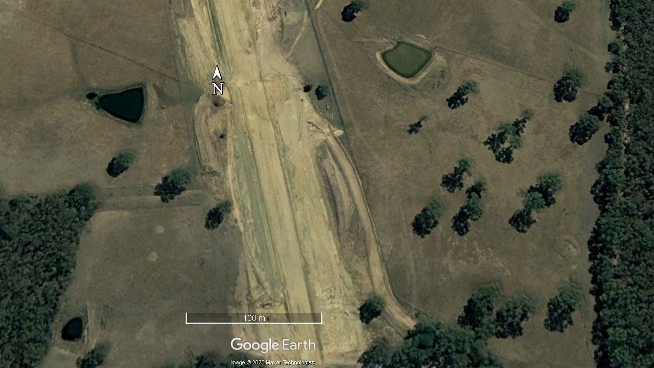
Visible still today are the scars of old quarries (2) on the northern slopes above Swing Bridge Road, near Potts Road. We know these quarries were in use by 1876 (Kyneton Guardian, May 6 page 3)
Today Swing Bridge Road is very rough, used mostly by bushwalkers and horse riders. Only the most intrepid four wheel drive vehicle owner would try to traverse the length of the track. Nevertheless it's quite a pretty walk.
Swing Bridge Road, Taradale
This road, which once led past a number of gold mines, became known as Swing Bridge Road because, while there has long been a ford at this spot on the Coliban River, a suspension bridge (hence the swing!) was erected across the river so pedestrians could keep their feet dry. We know it had been built by 1889 because the disastrous floods of January 1 swept it away, along with most of the bridges in the region
(The Age 1889 Jan 3, page 5). The suspension bridge was rebuilt and lasted many more years, and although it was washed away on a few more occasions, it was always replaced or repaired. That is until, finally, it fell into disuse and became unsafe to use. The map shows its likely location (6). It was a little distance upstream, about 40 m, from Kirks Ford (4). A pile of wood seems to be the only remains of the bridge.
a few boards, all that's left of the swing bridge at Taradale
Site of the demolished swing bridge
Further downstream, Kirks Ford provides a shallower crossing point, but even in a dry Summer it still presents a daunting sight for vehicle owners wishing to cross at this point.
There's a mullock heap (5) near where the swing bridge once stood, on the west side of the river, a memento of a short lived mining venture.

One of the many short-lived mines in the area (5)
The Survey Plan, Sheet No.1, Victoria Gold-field Taradale, (Earth Resources Victoria) provides a wealth of information on the early mining history of this area. This excerpt of the map shows that where the swing bridge was located, a dam had been built and a race led off to J. Rea & Co's sluicing claim further downstream. It also gives the location of C. & H. Choclat's water driven granite crushing machine, not far upstream from here, powered by water brought via a race cut from a point higher up the Coliban River. (Mount Alexander Mail, 14 June, 1861, page 5).
There's no sign of the dam these days and Rea's race and the site of the granite mill are both within freehold land, so it's time to continue our walk. As we want to keep our feet dry, and we can no longer rely on the swing bridge to do so, we will have to cross the Coliban River at a shallower point nearer the ford. Luckily, some kind person has installed a board, chained to a log, so we will have to walk the plank.
When the Coliban River is in flood it can be quite dangerous to cross at the ford. In 1866 John Connor and his horse and cart were swept away, surprised by a sudden rise in level due to heavy rainfall higher up the catchment. His body was later recovered some distance downstream from the ford (Mount Alexander Mail, Sept 26, 1866 page 2). There's a number of old gold mines on either side of the track. The Argyle reef workings (8) can still be discerned on the hill north of the road (on the other side of the creek) and the Bonaria Reef diggings (9) can been found a hundred metres off the track to the right.
Bonaria Reef diggings
Swing Bridge Road rises until it meets the Calder Freeway (10). It once passed Girvan's farm, a prominent landmark in the area but the farm was demolished and erased completely when the Freeway was constructed.
Girvans farm, 2004, Google Earth
Same view, 2006, Google Earth
You, the walker, now have a choice. You can return the way you came or you can do what Tyrone Thomas advised, cross over the Taradale-Metcalfe Road and return to Taradale via the Plantation Track (which veers off to the south) in the Taradale Nature Conservation Reserve. This track is a pleasant walk through natural vegetation. It passes the site of a now cleared pine plantation, and returns to the main road a kilometre closer to Taradale, after which there's little choice but to walk along the road verge.
Plantation Track, Taradale Nature Conservation Reserve
However, the bonus is that, once you finally emerge out of the Nature Reserve, you will pass by some very interesting history. Before the road bends to the south, you'll pass Diss Road on your right. This was the Dalhousie Township Precinct (11). It was gazetted as such in 1885. W. Todd purchased many of the allotments over several years from 1885 onwards. Apparently the house at the northern end of Diss Road was lived in by Frederick Diss, a miner, in 1868. There was also a mine and battery near here.
Closer to river is the site of Pollywell's Steam Crush Machine (12). As the crossing point in 1861 seems to have been at a different place than the later built Todd's Bridge (13) built in 1870, it's hard to know if this was upstream or downstream of the bridge.
On the other side of the bridge, are the remains of the District Survey Offices- the base for the early surveyors. If you look at some of this region's early allotment maps, at the bottom you will see that the Survey Offices, Taradale are credited with the work. In the paddocks on your left (east) there are some building remains, some bricks in one area and rows of wooden stumps nearby. However it's possible that the latter may well be the remains of a tannery.
Further along, after the road bends, to the west, on your right, you'll pass what was once a golf course although it's hard to imagine playing a round on it these days. Apparently, the Taradale Golf Club hosted regular matches and an annual championship, the last of which was held in 1958.
Underneath the impressive railway viaduct you might take a minute or two to read the plaque attached to a pier to learn of its history and why steel piers were installed to strengthen the bridge.
The Taradale Viaduct, A. Morris & Co., photographer. [ca. 1861] State Library
Once you reach Potts Road you can turn right, head north and return to your car which is either parked at the Taradale railway station or further along near Kirks Ford.
Believe you me, this is only a part of the history of this walk. This blog would have been twice the length if I'd told all. (Whew!).
I hope you're feeling a lot fitter and even better, entertained and informed!
The now disused Taradale Railway Station, Collins, John T., photographer. 1976 State Library


Comments
Post a Comment